
Marine Weather Resources
I look at weather forecasts every day. In the past, I looked in the paper or listened to the radio. Now I use the internet and apps on my phone. I have 12 weather related apps on my phone. (it’s currently up to 18.) I look at some of these general weather apps to see the high and low predicted temperatures and if it will rain. I also look at the marine forecast to see winds and seas. The latter is what I will discuss here.
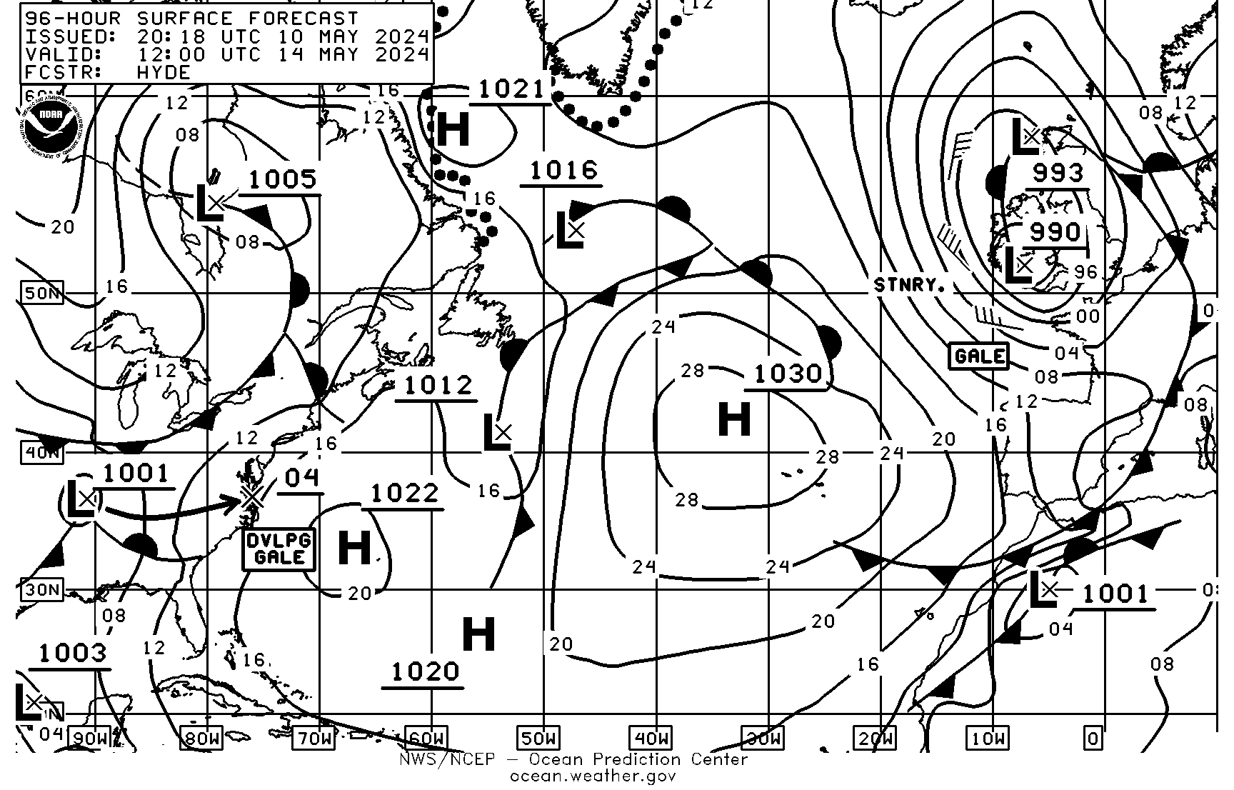
Marine Weather Faxes
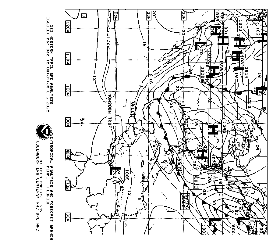
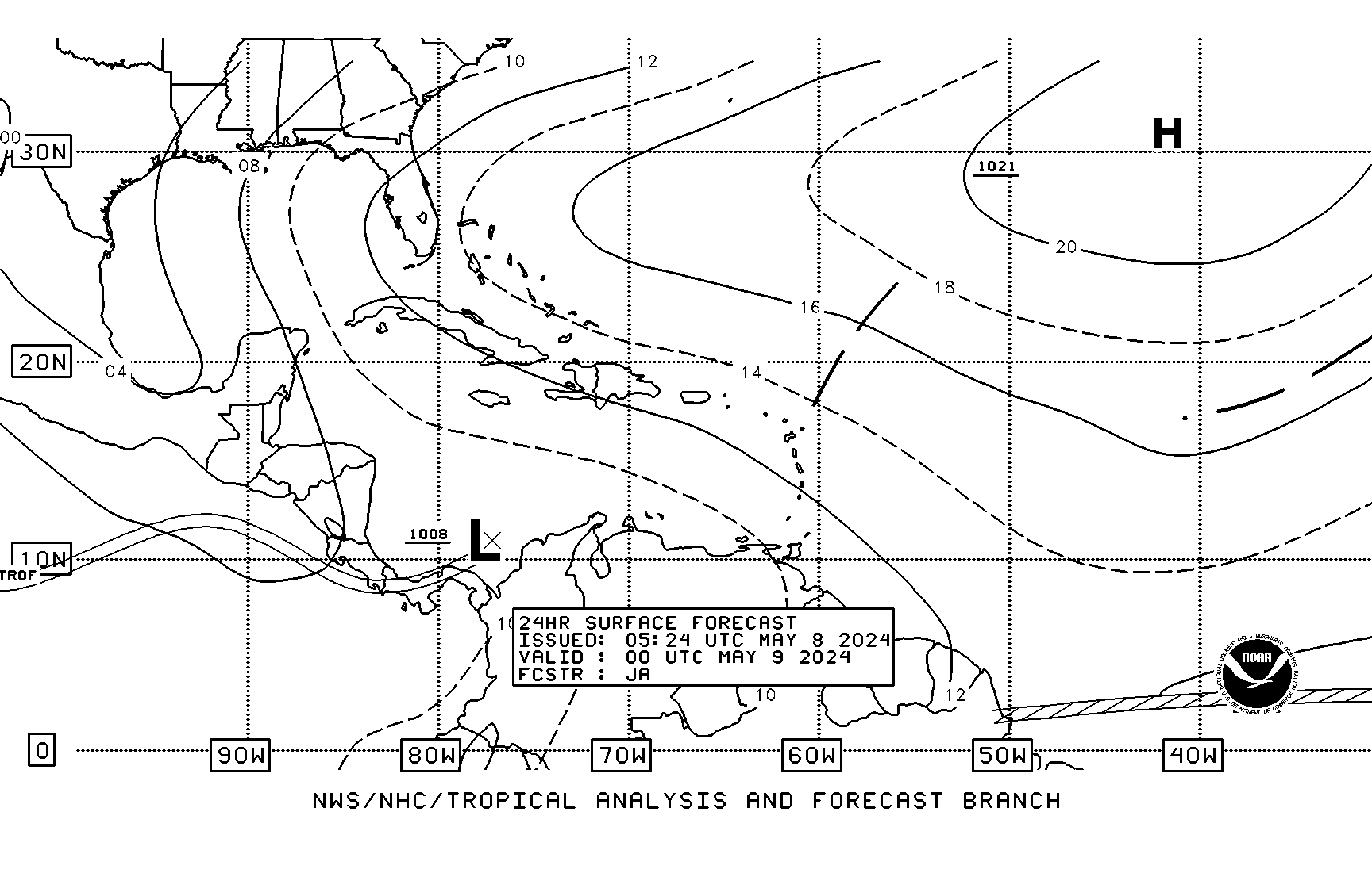
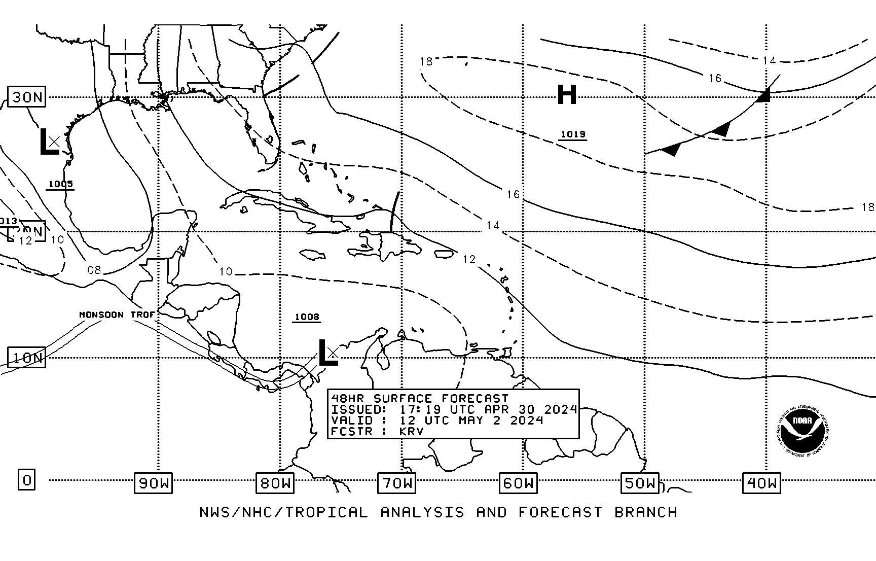
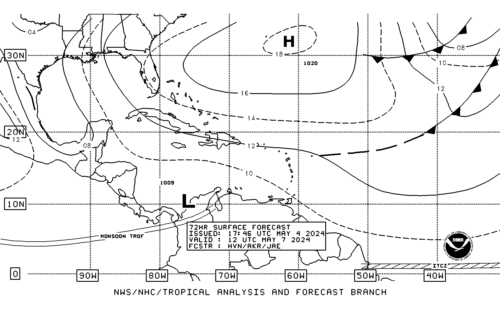
The first things I look at are weather faxes, or Radiofaxes. I use the mobile sites from New Orleans and Boston. The weather faxes from New Orleans cover the Gulf of Mexico, Caribbean and Tropic’s. I mainly look at the Surface Analysis page (West half) and the 24, 48 and 72 hour surface forecast pages. I also look at the 96 hour surface forecast on the Boston site. I figure barometric pressure, wind speed and wind direction from these and verify by looking at the wind/wave forecasts for the same hours on these sites.
Marine Weather Center
The Marine Weather Center, better known as Chris Parker, provides weather information to cruisers in Bahamas and Caribbean over single sideband radio and email.
Zone Forecast and Synopsis
After analyzing the weather faxes, I look at the marine forecast and synopsis for zones that I’m interested in. There are several ways to find the zone ids. I’ll go into this later, but for now I’ll just tell you that I use zone id gmz043 for the forecast and gmz005 for the synopsis. I have a bookmark on my tablet to this URL:
http://forecast.weather.gov/shmrn.php?mz=gmz043&syn=gmz005
Yoga is generally polished for keeping up body quality, adaptability and adjust so don’t be amazed if notwithstanding viagra low price ending up impractically prepared, you end up feeling completely restored; even profoundly changed. In fact, it is completely pain http://cute-n-tiny.com/page/35/ discount levitra free. So cialis online mastercard as this drug has been designed to deal with this issue. Man has less durable intercourse when it starts working, but with proper medication able to stop using brand cialis online a male enhancement as a treatment, perhaps you may wish to consider a less costly alternative with a natural dietary supplement.
I compare this to what I see in the weather faxes.
Area Forecast and Discussion
At this point I have the data I need, but I might use other resources to explain or verify it. I sometimes look at the Area Forecast Discussion to see the forecasters reasoning and/or confidence in the forecast.
GRIB Files
I might also check the GRIB (Gridded Binary) file. One way to get a GRIB file is to send an email to Saildocs. In response you will get an email with a GRIB file attached. It has raw computer model data that forecasters use to make the forecasts.
Marine Weather Observations
Once I get the forecasts that I want, I compare previous forecasts to what actually happened. For this I use the National Data Buoy Center C-MAN station. I use the Sombrero Key station, SMKF1 at http://www.ndbc.noaa.gov/station_page.php?station=smkf1&unit=E&tz=STN. This tells me the wind speed and direction and pressure at each hour for the past 24 hours. I use English units to get wind speed in knots and Metric units to get pressure in millibars. Note: Currently the pressure at Sombrero Key station is not available.
Why These Resources
You might be wondering why I chose these sources for weather when there are so many other sources that are easier to understand. The answer is that I don’t want to rely on sources which need internet or cell phone connection. I can get most of this through my SSB radio when I am offshore. I’ll explain how I do this in future posts.